Select NOAA-NWS Forecast Office Text Products
(Product availability varies with seasons, forecast office, and weather.)
Graphical HWO for Boston/Taunton, MA
To Select Another NWS Office Click on Map or Choose from List
|
| Select Forecast Office: | Select Product: |
Experimental Enhanced Hazardous Weather Outlook
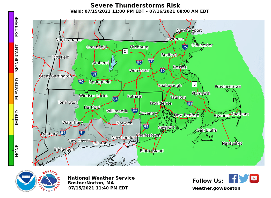
Severe Thunderstorm Risk

|
Risk Level
|
Definition Severe Thunderstorm Risk Day 2 to 7
|
|
|
|
None
|
No risk of severe thunderstorms.
|
|
|
Limited
|
Risk for severe thunderstorms with the
Probability of severe thunderstorms* within 25 miles of a point: Less than 15% Review weather safety tips and emergency kit. |
|
|
Elevated
|
Probability of severe thunderstorms* within 25 miles of a point:
Equal to or greater than 15%
Review weather safety tips and emergency kit. Identify closest safe shelter. |
|
|
Significant
|
Probability of severe thunderstorms* within 25 miles of a point:
Equal to or greater than 45%
Review weather safety tips and emergency kit. Identify closest safe shelter. |
|
|
Extreme
|
Probability of severe thunderstorms* within 25 miles of a point:
Equal to or greater than 60%
Review weather safety tips and emergency kit. Identify closest safe shelter. |
Products Courtesy of NOAA-NWS
NWS Information Parsing Script by Ken True at Saratoga Weather - WFO and Products Scripts by SE Lincoln Weather.
Mapping by Curly at Michiana Weather and by Tom at My Mishawaka Weather.